
AI for building roads
Automate estimation, scheduling, and job management with AI agents built for the way roads get built.
Every road,
measured instantly.
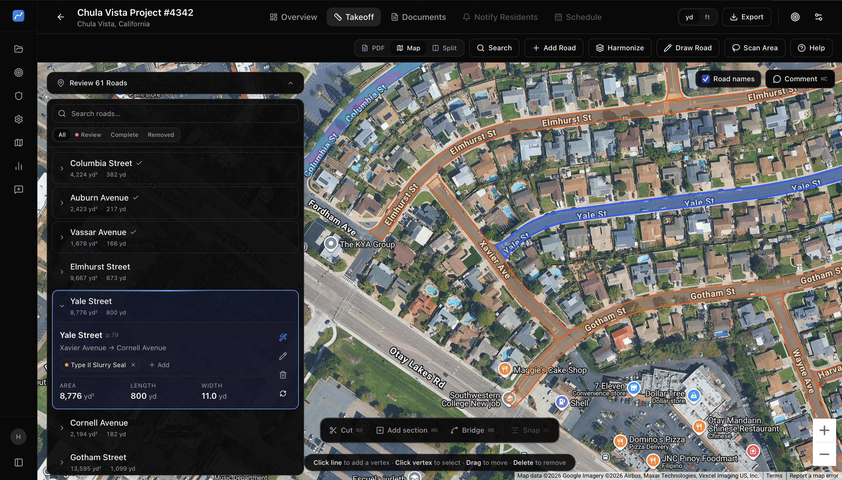
Upload your bid spec and our AI reads every street, maps it onto live aerial imagery, and measures the area, length, and width you need to price the job — in minutes, not days.
Built to move at the
speed of bid day.
Faster than manual takeoffs
Hours of measurement collapsed into minutes.
Measurement accuracy
Independently audited against surveyed ground truth.
Plan sheets processed
From rural shoulders to multi-lane reconstructions.
From PDF to bid
in three steps.
Upload your plans
Drag and drop PDF plan sheets. Any scale, any format — civil, roadway, grading, or utility plans.
AI extracts quantities
Our model finds the pavement surface for every road in the bid and measures area, length, and width precisely.
Export & bid
Review in an interactive dashboard, export to Excel, plug into your estimator, ship the bid.
Every detail,
accounted for.
Pavement quantities
Measures surface area, length, and average width for every road in the bid, straight from satellite imagery. Add your material rates and tonnage comes with it.
Preservation work types
Reads the treatments you actually bid — slurry seal, cape seal, microsurfacing, chip seal, mill & overlay — and color-codes every road by material.
Divided roads & complex geometry
Handles median-divided arterials per carriageway, and untangles L-shaped roads, loops, and multi-intersection streets so the right centerline gets measured.
Review, adjust & approve
Check every road on an interactive map, nudge a polygon where you need to, then approve. Export to Excel, CSV, KML, or PDF when the numbers are right.
Notify residents
Won the job? Mail postcards and letters to every address along the corridor, targeted by distance from the road — no list to build.
Schedule & manage jobs
Take awarded corridors from bid into crews, sequencing, and daily production tracking — closing the loop from estimate to build.
“What used to take our team three days now takes twenty minutes. The accuracy is remarkable.”
Nicholas Corcoran
Chief Estimator, VSS International
Tuesday · May 12
BlueRoad demo · 30 min
Ready to build roads
with AI?
Book a demo and see how BlueRoad fits into the way your team already works.